Sunday, June 24, 2012

South Boulder Peak

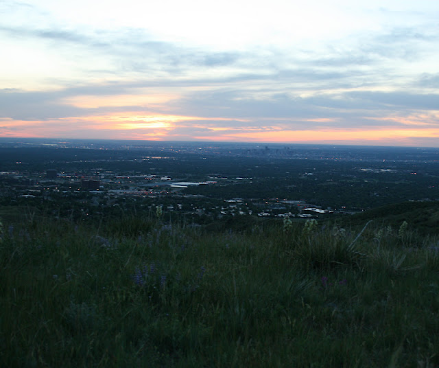
   A couple weeks ago, I hiked up South Boulder Peak with my friend Lindsay and her dog. We started at South Mesa trailhead and hiked up Shadow Canyon. This is the second time I have climbed up Shadow Canyon this year. I did it once before when hiking to the top of Bear Peak. South Boulder Peak is just to the south of Bear Peak, and was seemingly a bit less popular.
   The air quality was less than ideal with the High Park fire burning to the north. Likewise, our views were largely obscured from the smoke and haze. We started early in the morning, but it was still rather hot outside. We did notice an abundance of butterflies and dragonflies, which I assume is due to the unusually warm Spring we had.

Hesperis Fritillary Butterfly on a Horsemint Flower

Hesperis Fritillary Butterfly on a Horsemint Flower

Siva Juniper Hairstreak Butterfly on a Showy Milkweed Flower

Prickly Pear Cactus Flower

Saturday, June 23, 2012

McCullough Gulch

  The day after Run the Rockies, Nick, Lindsey, Andy (her fiance), and I went for a short morning hike in Blue River. On the way, we headed past the Quandary Peak trailhead, and I have never seen a more crowded trailhead in my life. Anyway, we headed down to the end of the road. We hiked past what appeared to be a mine, which is still in use. The we hiked along a small creek quite steeply up along the south side of Quandary. It was another gorgeous morning. The moon was out and there wasn't a cloud to be found. We hiked up to waterfall, where I took some photos of Lindsey and Andy for their "Save the Date" cards. Then, we continued up a little further to a lake just below Fletcher Mountain. It was incredibly windy at the lake, so we did not stay long. Overall, it was a very nice hike and weekend in the mountains.


Parry's Primrose Flowers

Pinnate-Leaved Daisy Flowers

Jacob's Ladder Flowers


Run the Rockies 10K

  Two weeks ago, Nick and I drove up to Blue River for the weekend. We stayed with his friend from college, Lindsey, who lives at 11,200ft. I was hoping spending the night at this altitude Friday night would help me acclimate because her and I were signed up for Run the Rockies the next morning.
   Run the Rockies is a 10K/Half-marathon sponsored by Salomon. Lindsey and I ran the 10K (6.2 miles). Before the race, a bus dropped us off in Copper. The race route was a paved trail next to I-70 all the way to Frisco. Luckily, this route was slightly downhill the entire way.
   The race started at 8:30a. It was a little brisk but perfect running weather. I got a bit of a slow start. I tend to always struggle for the first mile or so on my runs until I get warmed up. Once I find my stride, it becomes a bit easier. After a couple of miles, I was feeling pretty good and was able to pick up my pace a bit. The scenery surrounding me was very beautiful. We ran next to a creek, small ponds, and through giant mountains, but truthfully, I was not paying that much attention. However, this run was definitely much nicer than the Cherry Creek Sneak, where we were running through the city.
    I had the same goal as last time, I just wanted to run the whole time, no matter how slow. Also, I had another secret goal, which I would not even admit to anyone else because I thought it was unattainable, which was to run the race in under 70 minutes.
   At around mile four, I started to feel a little tired. We were running strictly on asphalt, which I am not used to. I usually run on a dirt trail, which is much easier on your joints. I started to feel a little achy in my ankles, knees, and hips. However, I did not feel like I was injured, just achy. This is where the bargaining process began. I'm not sure if people realize that running is a real mental game. Some say, that if you can run 2 miles, you can run any distance because at that point it's all mental. I began fighting with myself internally on whether to stop or not, but I just kept trying to push the thoughts of wanting to stop out of my brain. Once I got into the actual town of Frisco, it seemed easy. My body was absolutely ready to quit, but mentally I was locked into finishing the race.
   I finished the race in 66 minutes and 55 seconds. My average pace was 10:45/mile, which is a huge improvement in speed from the Cherry Creek Sneak. In my age and gender group, I placed 44 out of 61 runners. For all women, I placed 168 out of 278. Overall I placed 303 out of 445 total runners. Also, I achieved both of my goals, even my secret seemingly unattainable one.
   After the race, they served us free fruit, beer, and pizza. Lindsey and I hung out in the park for a bit and relaxed. I was very glad I decided to push myself and take on this challenge. However, I'd be lying if I said I was eager to do another one. I may take on another 10K in the Fall, but until then I'm going to stick to shorter runs and running for fun.

Friday, June 15, 2012

Grays and Torreys Peaks

   Last Thursday, team Runs with Ptarmigans (Rob and Jody from MFP, and I) assembled to climb Torreys Peak (14,267ft), which is just outside of Idaho Springs. 
   Rob and I left Denver at 4:45a to beat any afternoon thunderstorms. We met Jody at the Bakersville exit, and she climbed in the Jeep with us. We headed up the sketchy dirt road a couple miles to the trailhead. There were a few others already there, but it was not crowded by any means.
   We began our trek at about 6:30a, high on confidence from having conquered Mount Bierstadt (14,060ft) the week before. The initial stretch of trail up Steven's Gulch is pretty level, but the beginning of the trail definitely offers a nice acclimation to the high altitude. Shortly after we started hiking, we spotted Grays Peak (14,270ft), Torreys sister peak to the south.
Grays Peak covered in a wisp of cloud
Torreys Peak
Grays and Torreys Peaks
Torreys Peak
    From here on, the trail began to get very steep and rocky. There seemed to be an abundance of wildlife and wildflowers, as well. We saw a ptarmigan, lots of pikas, some marmots, a mountain goat, a butterfly, and even some ladybugs.
Alpine Primrose

Marmot with a great view
Mountain Goat
Monarch Butterfly
Sky Pilot Flowers
    It took us close to 3 hours to reach the top of Grays Peak. We didn't stop for long, as it was very windy and a bit chilly at the top.
View from Grays - Tenmile Range and Breckenridge
View from Grays - Mt Evans and Mt Bierstadt
View from Grays - Kelso Ridge and Kelso Mountain below
View from Grays - Mosquito Range
View from Grays - Tenmile and Sawatch Ranges (Mt. of the Holy Cross in the distance)
 Then, we scrambled down a large boulder field on the northwest side of Grays leading to the saddle. Once we reached the bottom of the saddle, we began another steep climb to the top of Torreys Peak. From peak-to-peak it took us about another hour.
View from saddle
View of Grays from Torreys
View from top of Torreys
    Honestly, I was feeling a little more overwhelmed on this climb than I felt on Bierstadt the week before. I was experiencing some very mild altitude sickness; a little dizziness, some lack of coordination, and a light headache. Also, I was extremely fatigued after having only slept 3 hours the night before due to severe thunderstorms and tornadoes late in the night. However, I worked real hard to keep myself properly hydrated, and I refueled with high-carb snacks every couple hours. Likewise, I gave myself constant reassurance in my ability to make it to the top. I have found a positive and determined attitude can make or break just about anyone on a difficult hike.
Me on top of Grays with the trail up Torreys to the right
    After conquering both peaks, I definitely had that Rocky Mountain High. There aren't many better feelings in life. We took our time getting down, as it is incredible easy to slip and fall on a snowfield or on loose rocks, especially when having fatigued legs. On the way back, we excitedly and tentatively planned future trips for team Runs with Ptarmigans. We reached the car in about 3 more hours. It took us about 7 hours overall.
    I am now up to 4 out of 10 peaks climbed for 2012. I am still a little nervous about having enough time to reach this goal, but I think it is doable and realistic. If we have another dry winter, I can likely keep climbing peaks well into September and October, before it gets too snowy. However, I'm not sure my goal of backpacking 50 miles this summer is going to happen, with most of my focus placed on peak bagging. In the end, I know all that matters is that I remain driven, goal-oriented, healthy, and that I'm having fun.

Doudy Draw Trail

   A week and a half ago, I went horseback riding with Mom at Doudy Draw trail in Boulder County. She was gracious enough to let me ride her horse, trusty old Butch. He really is the sweetest horse out there. We rode for about 5 miles, which was enough for me and left my butt and knees feeling a little sore. Hopefully next time, I can push myself a little further.


Tuesday, June 12, 2012

Squaw Mountain

The same day as our sunrise hike, we drove up to Evergreen and hiked up Squaw Mountain (11,486ft). I have been snowshoeing up the road a couple times during the winter but have never made it to the top. After a brief scramble, we found ourselves above the trees with magnificent views of the Front Range.


Sunrise Over Denver

   Two weekends ago,  we got up at 4am and headed towards Green Mountain in Lakewood with friends. We climbed to the top and watched the sunrise. It was a peaceful and magical morning.


Tuesday, June 5, 2012

Horseback Riding - Before/After

Mom took me horseback riding yesterday at Doudy Draw Trail in Boulder, which I will get more into later. However, this morning she sent me a picture that she took of me riding one year ago. The difference is quite striking. Last year, I couldn't even get on the horse without a step or a rock. Yesterday, I got right up from the ground with no difficulty. 

June 2011

June 2012


Mount Bierstadt

   Last Thursday, I climbed Mount Bierstadt (14,060ft). It was my second peak above 12,000ft for the year. I was accompanied by two new hiking buddies, Rob and Jody, who I met on MyFitnessPal. Rob and I met Jody in Georgetown early in the morning and then drove up to the top of Guanella Pass. I was relieved to find the winds had calmed down quite a bit from when I was up there on Memorial Day. It was still a little windy but much more tolerably so. The temperature was a bit cool, but it felt very nice once I started to heat-up from hiking up the steep mountainside.
   Mount Bierstadt is one of the easier 14ers in Colorado. Mind you, easy is a relative term here, as it is 3.5 miles one-way and about 2850ft gain. There were a few patches of snow closer to the top, but they were fairly easy to traverse. We made it to the summit in about 2 hours and 40 minutes. We relaxed for a bit at the top to take in the beautiful scenery, and we signed the registry. It took us about 2 hours to get back down, and the weather cooperated fully. It was just another day I feel truly blessed to live in such a beautiful place.
   On our way back, we stopped in Genessee for a couple of slices of NY Style Pizza, a beer, and some chit chat. Rob and Jody were great hiking buddies. They offered interesting conversation, fun company, and most importantly had positive attitudes. We all agreed to make our Thursday 14er climbs a ritual.
  On a personal level, I was pleasantly surprised to find myself feeling a lot better than I felt on the two 14ers I climbed last summer. I did not feel any altitude sickness at all. My legs were definitely burning during the hike, and I had some cramping later that night. However, I had no soreness whatsoever the day after, and I even went for a short run.
   I'm anxiously looking forward to my next adventure above 14,000ft.

Mt Evans, the Sawtooth, Mt Bierstadt

Guanella Pass

Sawatch and Tenmile Ranges

Mt Evans

Rob, Jody, and I at the summit

The Sawtooth - daring people traverse this ridge to Mt Evans

Mt Evans and Abyss Lake

Frozen Lake and South Park

The summit and with a view of Grays and Torreys Peaks

The Sawtooth

Square Top Mountain